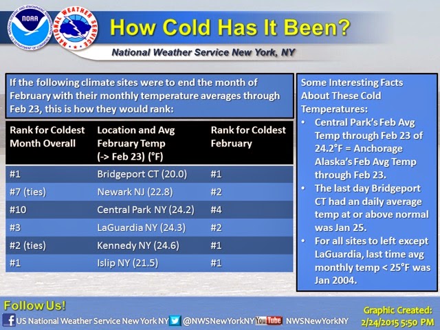
We might not have the record snow of Boston (where season totals just topped 100 inches last night 2/24/15) but down here along the Connecticut coast we're on the brink of having not only the coldest February on record but also the coldest Month on Record!
Bridgeport, Connecticut is the official coastal weather station for the area. It is located on the eastern edge of Fairfield County and is only a town over from my hometown. National Weather Service climate data for coastal Connecticut is taken at this station.
One thing to note about this station, where sub-zero temps are actually very hard to attain, is that the weather station sticks out on a small piece of land that juts into Long Island Sound. This has a moderation effect on the stations records since its surrounded on three sides by the warmer waters in the winter and cooler waters in the summer.
Although this winter, even the waters of Long Island Sound have gotten really cold! Check out these photos I took of
sea ice in Long Island Sound.
So with only a few days left in the month of February, will February 2015 go down as the coldest month on record (aka the coldest month in a hundred years!)? We'll find out in a few days!
In the meantime, check out the graphic released by the National Weather Service below!